City Analytics Platform

We are helping Governments to build "Feasible, Impacting and Sustainable" Cities. Our solution will help authorities run and maintain a smart city efficiently.

One-Stop Analytics Platform

Our advanced City Analytics Platform delivers 3D Map of the entire city.   The platform uses Machine Learning algorithms to automatically identify all your assets and tag them as per their asset class.  The platform also comes loaded with Augmented Reality and Virtual Reality visualizations for smarter decision making.

3D map of entire city

The 3D map gives a realistic perspective of the entire city for well-informed decision making.

High resolution aerial view

A bird's eye view of the entire city that can be zoomed up to centimeter level detail.

Machine Learning based classification

Buildings, roads, trees, poles, hoardings, and many more are automatically classified using our Machine Learning based "3rdi" engine.

Enforcement Module

Enforcement module supports payment collections from utilities, properties, violations, etc.

Advanced analytics

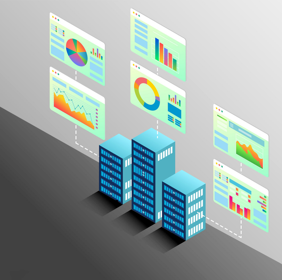
Run heat maps, time-series, forecasting, root-cause analysis, simulations, pattern identification, predictive modeling, optimization, etc.

Augmented Reality and Virtual Reality

Realize the entire city using Augmented Reality and Virtual Reality gadgets based on your requirements of collaboration and showcasing.

Powerful collaboration Tools

Chats, Multi-user project collaboration, Virtual Reality and Augmented Reality collaboration, Reviewing and many more tools are available

Project Plan integration

The 3rdi system directly integrates with your project management tools such as Primavera and MS Project for tracking the project progress using "3rdi Realize" tools

On-Premise and Cloud Deployment

Based on your requirement, our 3rdi engine can be deployed on-prem or on-cloud ensuring privacy and data availability at all times.

Rise to the top

Be the First

Make your city the foremost city in your country to have the most advanced “City Analytics Platform” that maps all your assets, processes and people for better management and coordination among departments

count on us

Mapping and Analytics Experts

We provide you the most cutting-edge planning, development, monitoring and analytics tool for the information at your fingertips so that you can make best decision for your city.  

Data Integrity

Single Source of Truth

With all the systems integrated with out platform, your city enjoys the benefits of having “Single Source of Truth” at hand anytime.  Our team of experts are always available to integrate your disparate systems with aplomb. 

We Have Great Answers

Ask Us Anything

The accuracy we assure is 3Cm relative accuracy.

It would be depending on the scope of work and the deliverable.

Depending on the surface model, (Barren land, forest area, hills, buildings) the parameters would change.

Yes, we can map all the payment with the map and give real time monitoring.

We strive to make our clients happy

So, let's be happy together

want more details?

Fill in your details and we'll be in touch